
 01 / 01
GEOMATE
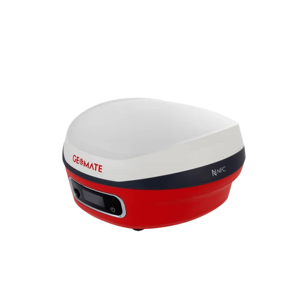
GeoMate SG7 IMU-RTK GNSS Receiver
HIGH-PRECISION IMU-RTK GNSS RECEIVERPremium 1608-channel multi-constellation GNSS RTK receiver featuring calibration-free IMU tilt compensation up to 60°, integrated 4G LTE modem, internal transmit/receive UHF radio, and IP67 magnesium alloy rugged housing.
Channel Tracking1608 multi-constellation channels tracking GPS, GLONASS, Galileo, BeiDou, QZSS, and SBAS
Tilt CompensationCalibration-free IMU tilt compensation up to 60° with 2.5 cm survey accuracy
Configuration, availability and delivery confirmed with your quotation.
01 / FIELD CAPABILITIES
Built for the task.
- 1608-channel multi-frequency architecture tracks all global GNSS constellations simultaneously
- Calibration-free IMU tilt compensation allows accurate surveying at pole angles up to 60 degrees
- Integrated internal UHF radio and 4G modem eliminate external cables and external battery packs
- IP67 sealed magnesium alloy chassis withstands severe rain, sandstorms, and 2-meter drops
- One-touch NFC pairing connects immediately to field controllers running MateSurvey software
02 / TECHNICAL DETAILS
Precision, specified.
- Channel Tracking
- 1608 multi-constellation channels tracking GPS, GLONASS, Galileo, BeiDou, QZSS, and SBAS
- Tilt Compensation
- Calibration-free IMU tilt compensation up to 60° with 2.5 cm survey accuracy
- RTK Positioning Accuracy
- Horizontal: 8 mm + 1 ppm RMS; Vertical: 15 mm + 1 ppm RMS
- Internal Radio Modem
- Integrated TX/RX UHF radio transceiver (410–470 MHz) with selectable power up to 2W
- Wireless & Cellular
- Integrated 4G LTE modem, Wi-Fi 802.11 b/g/n, Bluetooth 5.0, and NFC touch-connect
- Battery & Autonomy
- Dual internal high-capacity batteries delivering up to 15 hours continuous RTK rover operation; USB-C fast charging
- Ingress & Drop Protection
- IP67 dust and waterproof rating; withstands 2-meter pole drop onto concrete
- Operating Temperature
- -40°C to +75°C (-40°F to +167°F)
Key specifications and field-use details. Exact configuration may vary by model or selected variant.
GeoMate
Professional GNSS positioning, RTK surveying, visual laser rovers, and rugged field data-collection systems.
CONTINUE YOUR EXPLORATION
All products COMPLETE YOUR FIELD KIT.
YOUR NEXT EXPEDITION STARTS HEREBig terrain.
Big terrain.
Bigger possibilities.
Tell us where you're headed.
We'll help you get equipped.