
 01 / 02
GEOMATE
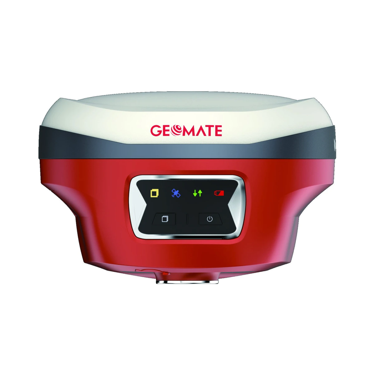
GeoMate SG6L GNSS Visual Laser Rover
VISUAL LASER GNSS ROVERUltra-compact 800 g visual RTK rover with 1892 channels, integrated 50 m green millimetre laser for non-contact measurement, dual augmented reality cameras for immersive stakeout, and 60° calibration-free IMU tilt compensation.
TURNKEY RTK SYSTEM AVAILABLEAvailable individually or as part of the turnkey GeoMate Complete RTK System.
View Complete RTK System Channels1892 channels multi-constellation GNSS
Constellations TrackedGPS (L1 C/A, L1C, L2C, L2P, L5), GLONASS (L1, L2, L3), BeiDou (B1I, B2I, B3I, B1C, B2a, B2b), Galileo (E1, E5a, E5b, E6), QZSS (L1, L2, L5), NavIC (L5), SBAS
Configuration, availability and delivery confirmed with your quotation.
01 / FIELD CAPABILITIES
Built for the task.
- 1892-channel tracking engine with full constellation support ensures rapid RTK fix in under 5 seconds even under dense tree cover or urban canyons
- Integrated 50 m green millimetre laser measures inaccessible or hazardous points (cliffs, ravines, transformer yards, highway medians) with point-and-click ease
- Dual augmented reality (AR) cameras project intuitive 3D field arrows on live screen for effortless stakeout and photogrammetric 3D point cloud generation
- Third-generation calibration-free 60° IMU tilt sensor eliminates pole leveling, boosting daily survey productivity by over 30%
- Featherweight 800 g magnesium-aluminum alloy body reduces operator fatigue during long days in the field
- 9,600 mAh high-capacity internal battery provides 18 hours of continuous operation on a single charge with Type-C power bank charging
- IP68 environmental rating ensures complete submersion protection and total resistance to fine dust, sand, and heavy downpours
02 / TECHNICAL DETAILS
Precision, specified.
- Channels
- 1892 channels multi-constellation GNSS
- Constellations Tracked
- GPS (L1 C/A, L1C, L2C, L2P, L5), GLONASS (L1, L2, L3), BeiDou (B1I, B2I, B3I, B1C, B2a, B2b), Galileo (E1, E5a, E5b, E6), QZSS (L1, L2, L5), NavIC (L5), SBAS
- Visual Measurement / Laser
- Integrated green laser pointer & distance meter (range up to 50 m, accuracy ±(2 mm + 0.1 mm/m))
- Dual AR Cameras
- 2 MP front camera for AR stakeout + 5 MP bottom camera for image measurement / 3D photogrammetry
- IMU Tilt Compensation
- Calibration-free 60° IMU tilt sensor immune to magnetic interference (tilt accuracy < 2 cm at 30°)
- RTK Positioning Accuracy
- Horizontal: 8 mm + 1 ppm RMS / Vertical: 15 mm + 1 ppm RMS
- Laser Surveying Accuracy
- Centimetre-level coordinate measurement at distances up to 50 m without pole placement
- Internal UHF Radio
- Built-in receiving / transmitting UHF radio (410–470 MHz)
- Cellular & Wireless
- Bluetooth 5.3, Wi-Fi 802.11 b/g/n, NFC one-tap pairing, 4G LTE network RTK
- Battery & Autonomy
- Integrated 9600 mAh Li-ion battery supporting up to 18 hours continuous rover operation
- Fast Charging
- USB Type-C PD 15W fast charge (fully recharged in ~3.5 hours)
- Environmental Protection
- IP68 certified waterproof & dustproof, 2 m drop onto concrete
- Weight & Dimensions
- 800 g | 133 mm diameter × 87 mm height
- Operating Temperature
- -40°C to +75°C
Key specifications and field-use details. Exact configuration may vary by model or selected variant.
GeoMate
Professional GNSS positioning, RTK surveying, visual laser rovers, and rugged field data-collection systems.
CONTINUE YOUR EXPLORATION
All products COMPLETE YOUR FIELD KIT.
YOUR NEXT EXPEDITION STARTS HEREBig terrain.
Big terrain.
Bigger possibilities.
Tell us where you're headed.
We'll help you get equipped.